Peneda-Gerês
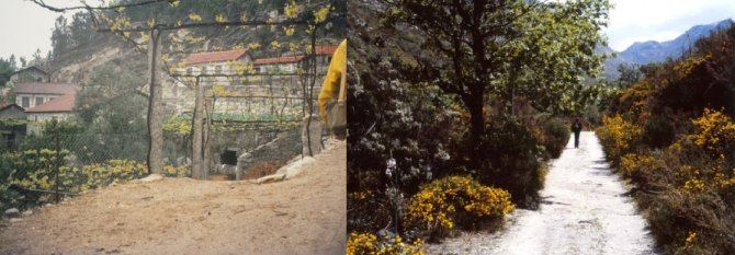
Peneda-Gerês is a mountainous area located in the Northwest of Portugal, including a large part of the mountain ranges of Peneda, Soajo, Amarela, Gerês and Larouco.
This site includes the only national park in the country and it has been designated both as an SCI (PTCON0001; 88845 ha) and an SPA (PTZPE0002; 63438 ha). The area presents a large altitude gradient (from 60 to 1545 m), with 63 % of its area at elevations above 800 m, and is located in a major bioclimatic transition, between the Atlantic and the Mediterranean biogeographic regions of Europe. The diverse geomorphologic and physiographic conditions, and a dense hydrographic network, further contribute to a rich ecological diversity.
Mountain rural landscapes and grazing lands include extensive areas of Annex I habitats, namely native oak forests (9230), hay meadows (6510) and heathlands (4030). The two latter habitats are declining in favour of the former due to decreased husbandry and management of meadows. These species-rich landscapes also include frequent representations of priority habitats like wet heaths (4020*), acid grasslands (6230*) and riparian forests (91E0*), and populations of several plant and animal species listed in the Annexes of the Habitats and Birds Directives. Dry pioneer grasslands with dwarf chamaephytes (6160) and saxicolous habitats (8220, 8230) are particularly rich in endemic plant species. Mires and bogs are residual habitats (7140, 7150) in these landscapes but they are of high conservation value due to their extreme biogeographic location.

In lowland areas, oak forests are frequent on oligotrophic soils of slopes (9230) and on mesotrophic soils of valleys (9160). In gorges and along streams, laurel-leaved forests and scrublands (5230*) are also common. Together with riparian forests (91E0*), these are the most species-rich and ecologically significant habitats in lowlands. Heathlands (4030) and dwarf chamaephytic formations of rocky soils (8230) are common in areas subjected to wildfires.
Recent changes in the landscape highlight the reduction of agricultural areas, with frequent and diverse transitions towards forest and semi-natural classes, as a result of external drivers and socio-economic internal dynamics, including a widespread demographic decline. More recently, windmill farms for energy production are being installed on mountain tops neighbouring the site.
In lowland areas, urban development, intensive forestry with exotic species, changes in fire regimes and installation of hydroelectric dams for energy production have been the most important processes and drivers of landscape change. In recent years, widespread invasion by alien plant species has become an important driver of biodiversity change, and it is spreading to higher elevations.
Main data available for the site:
- Orthoimagery (2002, 2004)
- Landsat TM and ETM+ and SPOT5
- Habitats map (2007)
- Land cover maps (COS90, COS00; COS06)
- Land use change maps 90-00
- Species records
- Moderate resolution long term time series (MODIS)
Several thematic ancillary datasets are available for the site, namely climate, hydrography, geology, soils, socioeconomic and demographic data, agrarian censuses (farm structural survey data), forest surveys (national inventory), wildfires, and road network.
