News
ISRIC releases upgraded SoilGrids system: up to two times improved accuracy of predictions
ISRIC – World Soil Information has just released a major update of its global predictions of soil properties and classes, now available at a spatial resolution of 250 m. The previous SoilGrids system at 1 km resolution has been systematically upgraded and the accuracy of the predictions has been improved (up to two times) compared to the previous predictions. The new version of SoilGrids predictions comes with an open data licence, i.e. it is available at no cost.
Global soil information based on Machine Learning
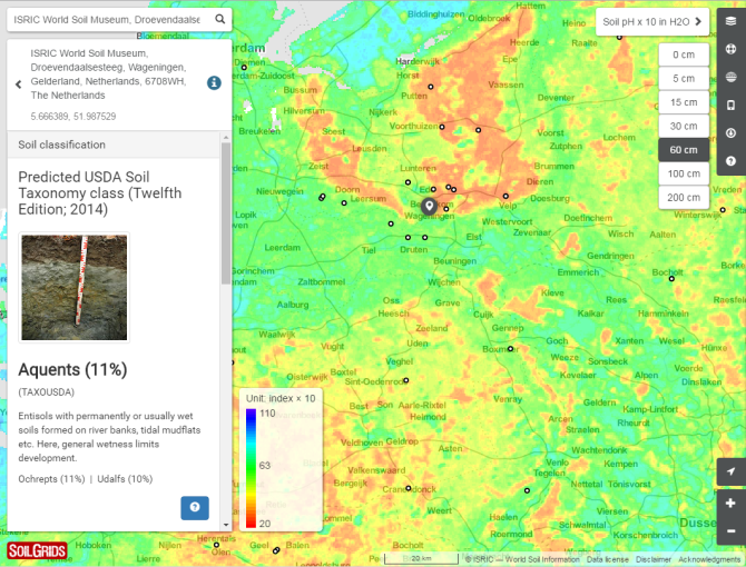
SoilGrids (www.soilgrids.org) provides public access to global soil maps for a number of useful soil properties — organic carbon, bulk density, Cation Exchange Capacity (CEC), pH, soil texture fractions and coarse fragments — at seven standard depths (0, 5, 15, 30, 60, 100 and 200 cm). Maps of depth to bedrock and the distribution of soil classes based on the World Reference Base (WRB) and USDA classification systems are also included in the release. Predictions are based on using state-of-the-art Machine Learning algorithms that allow for complex non-linear relationships and optimal partitioning of environmental feature space. SoilGrids is a result of extensive collaboration with partner institutes across Europe, Asia, North America, Africa, Oceania and Latin America.
Higher resolution soil grids to feed global crop modelling projects
A group of researchers from the International Institute for Applied Systems Analysis (IIASA) and the Joint Research Centre (JRC) have recently shown that soil data is one of the key factors affecting the outcomes of global gridded crop models, especially when estimating the impact of climate change on yield. They concluded that: "soil characteristics and data have an undeniable impact on uncertainty in estimates of crop yields under climate change" (Folberth, C. et al. 2016; Nature Communications). With its improved accuracy, SoilGrids aims at helping bridge that gap.
Higher accuracy
The average accuracy of the new maps is up to double that of previous versions (i.e. models explain up to two times more variation when evaluated using cross-validation). Likewise, substantially more spatial detail has been achieved in moving from 1 km to 250 m resolution. The improvements in accuracy can be attributed to the use of multiple machine learning algorithms; more comprehensive satellite-based environmental sensor data (at finer resolution) and an increased number of soil profile observations that have been better harmonised across countries.

Open soil data
We have released the SoilGrids predictions under the Open Database License (ODbL) v1.0 (see links below) because we are convinced that scientists, land managers, policy makers, private sector entities and civil society need more, and more open, information on the characteristics of our soils in order to manage and protect them effectively. Access to SoilGrids maps is provided via a soil web mapping portal at SoilGrids.org; through a Web Coverage Service (WCS); and via the SoilInfo App. It is noteworthy that SoilGrids was entirely created using Open Source software including the R environment for statistical computing and several OSGeo solutions for processing and visualizing spatial data (GDAL, SAGA GIS, QGIS, Geonode and Geoserver). All processing steps used to generate SoilGrids are documented via ISRIC’s institutional Github account, allowing for complete system transparency and reproducibility.
Join the SoilGrids effort
The SoilGrids team is now especially interested in developing methods for combining SoilGrids predictions with local and/or national gridded soil products (e.g. 100 m and 30 m spatial resolutions) so that increasingly more accurate, useful and consistent global soil information can be produced for use by the international community. If you work on developing local or regional soil maps compatible with SoilGrids, please consider contacting the SoilGrids development team to receive more information on how to help improve SoilGrids locally and potentially collaborate on creating regional maps. If you have GPS located field observations or laboratory data for soil profiles (one or more depths) please consider contributing them via ISRIC’s World Soil Information Service (WoSIS) so that they can be harmonized and included in creating the next update of SoilGrids. This process will likely increase map accuracy for your specific area. See also the section ‘Contribute’ at www.soilgrids.org.