
Back to profile
profile_subnav_contactperson - dr. J (Johannes) Reiche
type_page
News
-

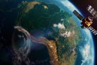
Integrating satellite-based forest disturbance alerts improves detection timeliness and confidence
| Integrating satellite-based forest disturbance alerts improves detection timeliness and confidence - WUR News Integrating satellite-based forest... -

AI reveals landscape patterns after deforestation in Africa
| AI reveals landscape patterns after deforestation in Africa - WUR News AI reveals landscape patterns after deforestation in Africa... -
AI system predicts illegal deforestation: Already prevented the clearing of 30 hectares near a gold mine'
| Ontbossing is één van de grootste bedreigingen voor het klimaat en voor belangrijke woongebieden van mens en dier. Forest Foresight, het... -

World Wildlife Fund and Wageningen University cooperate in monitoring illegal logging.
| World Wildlife Fund and Wageningen University cooperate in monitoring illegal logging. - WUR News World Wildlife Fund and Wageningen University... -

Open-access SEPAL implementation of BayTS Sentinel-1 alerts
| Open-access SEPAL implementation of BayTS Sentinel-1 alerts - WUR News Open-access SEPAL implementation of BayTS Sentinel-1 alerts Published on...