
Back to profile
Projects - prof.dr.ir. GBM (Gerard) Heuvelink
-
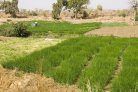
Climate-Smart Fertilizer Recommendations for Ethiopia
Climate-Smart Fertilizer Recommendations for Ethiopia - WUR Project Climate-Smart Fertilizer Recommendations for Ethiopia Ethiopia's rainfed-dependent... -
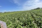
Modelling potato yield response to fertilizers and soil nutrients using semi-mechanistic models and machine learning
Modelling potato yield response to fertilizers and soil nutrients using semi-mechanistic models and machine learning - WUR Project Modelling potato... -
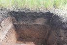
Modelling and mapping soil organic carbon in space and time using machine learning and mechanistic approaches
Modelling and mapping soil organic carbon in space and time using machine learning and mechanistic approaches - WUR Project Modelling and mapping soil... -

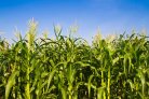
Variability in maize yield and response to fertiliser in Ghana
Variability in maize yield and response to fertiliser in Ghana - WUR Project Variability in maize yield and response to fertiliser in Ghana The... -
Enhancement of the use of machine learning in digital soil mapping
Enhancement of the use of machine learning in digital soil mapping - WUR Project Enhancement of the use of machine learning in digital soil mapping... -
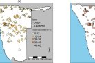
Digital soil mapping using uncertain soil observations to support sustainable agricultural intensification in West and Central Africa
Digital soil mapping using uncertain soil observations to support sustainable agricultural intensification in West and Central Africa - WUR Project... -

Space-time statistical analysis and modelling of nitrogen use efficiency indicators in China
Space-time statistical analysis and modelling of nitrogen use efficiency indicators in China - WUR Project Space-time statistical analysis and... -

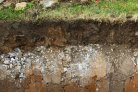
The development and use of a soil database with quantified uncertainties
The development and use of a soil database with quantified uncertainties - WUR Project The development and use of a soil database with quantified... -

Developing a high-resolution 4-dimensional soil modelling and mapping platform for the Netherlands (BIS-4D)
Developing a high-resolution 4-dimensional soil modelling and mapping platform for the Netherlands (BIS-4D) - WUR Project Developing a high-resolution... -
Machine learning for fertilizer recommendation in Ghana
Machine learning for fertilizer recommendation in Ghana - WUR Project Machine learning for fertilizer recommendation in Ghana PhD project Eric Asamoah...