
Agenda Archive
-

Improving WOFOST biomass and yield simulations: Assimilating leaf area index and canopy nitrogen content with the Ensemble Kalman filter
-

The Human Element: Integrating socio-economic variables in physics-based energy demand models
-

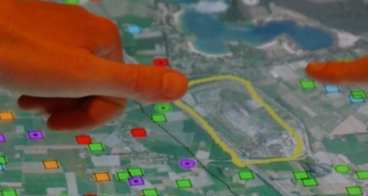
Assessment of Urban Energy Flexibility Needs: Dynamic Spatio-Temporal Visualization Approach Integrating Rooftop PV Projections
-
Using High-Resolution Satellite Imagery and Deep Learning to Map Artisanal Mining Spatial Extent in the DRC
-

Land Cover/Land Use (LULC) mapping and changemonitoring using remote sensing
-
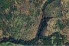
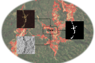
Texture analysis for detecting avocado orchards in Uruapan, Mexico
-

An indicator based approach to quantify river flood risk for the Maas river in Limburg - combining hazard, vulnerability, and exposure
-

Mapping Intertidal Seagrass with Sentinel-2 Imagery inthe North Frisian Wadden Sea and the Lindisfarne SPA
-

Identification of locations at risk for introduction of Asian Tiger Mosquitos (Aedes albopictus) with ground traffic transport in the Netherlands
-

Impact of training data characteristics on land cover mapping accuracy: An empirical study