Atlantic North (ATN)
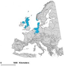
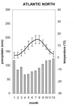
The Environmental zone Atlantic North covers uplands and low mountains in Central and Northern Britain, Northern Ireland and Western coast of Scandinavia, and lowlands and plains of Jutland and North Germany. The Atlantic ocean has a strong influence on the climate. The growing season lasts in average 255 days (199-278), the sum of temperatures above +10° is in average 3198,1° (2459 °- 3214 °). Both values are in the middle category.

The northern Atlantic zone lies on Caledonian structures, except the Archaean North-West Highlands. The segment in thw North-West Mountains constituted by Pre-Cambrian, the segments in the Southern Uplands, Lake District, Central Pennines and Cambrian Mountains by Silurian and Ordovician rocks. The North West Highlands, Grampian Mountains and Lake District are Block and Block-Folded mountains modified by abrasional and accumulative forms of mountain glaciation; Southern Uplands are denudational tablelands modified by mountain glaciation, and Cambrian Mountains are denudational tablelands modified by mountain glaciation and limited development of glacial-accumulative forms (predominantly on watersheds). The relief is dominated by pediment tablelands modified by abrasional and accumulative forms of mountain glaciation. The parts of the Atlantic northern zone in the Netherlands are underlaid by Palaeocene, Neocene and Quaternary deposits. North Germany is dominated by Miocene; the south-east of the German segment is dominated by Triassic, the south-west by Devonian and Jurassic (Teuroburger Wald) formations.

The Quaternary deposits within the British segment are dominated by moraines, in Holland also by moraines in the east and marine sediments in the west. Within North Germany moraines occur on elevated watersheds; the depressions are filled by fluvioglacial, valleys by alluvial deposits. Eluvial-deluvial formations dominate the rest of the German sector. Fyn is represented mostly by moraines (Riss I). The boundary of maximum extent of Brandenburg (Würm I) glaciation divides Jytland into two roughly equal sections – Eastern and Western, which therefore are dominated respectively by undifferentiated moraines and marginal glacial accumulative formations, and by fluvioglacial deposits. Marine deposits cover coastal areas in the Dutch segment, and lacustrin-glacial are present in Jytland and Fyn.
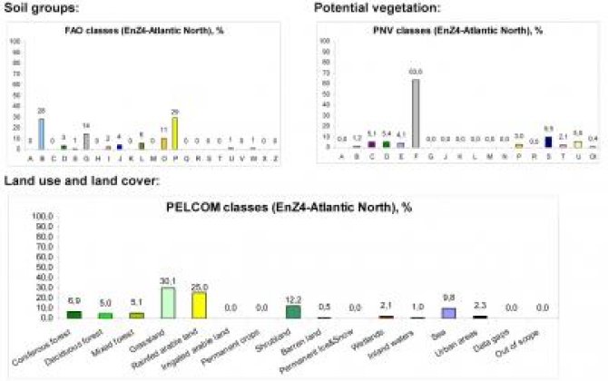
The natural vegetation consists of deciduous forests, except Scandinavia, which is dominated by coniferous and mixed formations. Agricultural lands occupy most of the area. They are mostly crops in the densely populated continental segment, and grasslands in much emptier North Britain and Scandinavia.The dominating land cover is grassland, bogs heathlands and oligotrophic birch-pine forests and birch-oak forests. Land use is dominated by dary cattle holding and sheep breeding. Large parts of the bogs in Scotland are currently planted with pine.
