
News
Scientist collaborate on the use of big data for monitoring ecosystem anomalies
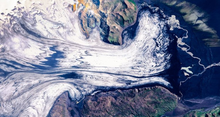
Climate and land use changes can have irreversible impacts on the biodiversity of terrestrial ecosystems. The consequences of these threats for our ecosystems are partially understood. European satellites give us a wealth of new data that can be used to study the fundamental changes and extreme events taking place on our planet. Evaluating this huge amount of data cannot be accomplished by individual researchers alone. Over the past four years, scientists from seven European countries have worked together intensively to investigate how satellite data can efficiently be evaluated and used for environmental strategies and monitoring.
Climate change, with the associated intensification of extreme meteorological events, and rapid land-use changes confront us with new global challenges. Any strategy for nature conservation and landscape protection requires a solid basis of data. Since 5 years, a new generation of European satellite observations - the so-called Sentinels - enable us to monitor the ecosystems of our globe. The huge amounts of incoming satellite data must be evaluated efficiently in order to detect changes in ecosystems early on. This is a challenging task that individual researchers cannot accomplish alone. Progress can only be made if environmental scientists team up with computer scientists and remote sensing experts. This has taken form in the EU-project BACI (Biosphere Atmosphere Change Index).
Tracking illegal practices
"The rapid development in sensing technologies and data science for understanding anomalies in complex data has become a crucial step for environmental research" explains Martin Herold, professor Laboratory for Geoinformation Science and Remote Sensing at WUR. WUR is one of the key partners of the BACI project. Herold: “We are excited that our developed satellite-based approaches enable us to detect new land use changes in forest ecosystems more timely and accurate then before. By providing this information in near real-time now enables enforcement actions to reduce unsustainable land practices. This adds a new dimension to environmental monitoring”.
Daily uptake CO2 on earth
The joint project, which was financed from the research and innovation program of the European Commission Horizon 2020, can boast several success stories. The project succeeded in combining radar and optical data that contribute to, for instance, determining biodiversity and land use patterns in forest ecosystems. By combining satellite data and measurements of carbon dioxide exchange between ecosystems and the atmosphere using machine learning methods, it was, for the first time, possible to visualise the daily CO2 uptake of the entire Earth. “Most of these breakthroughs were only possible due to unconventional ways of using artificial intelligence methods” says Herold. “This allows us to study the links between the biosphere and land use systems”.
")