
Project
A data-driven reconstruction of historic land cover/use change of Europe for the period 1900 to 2010
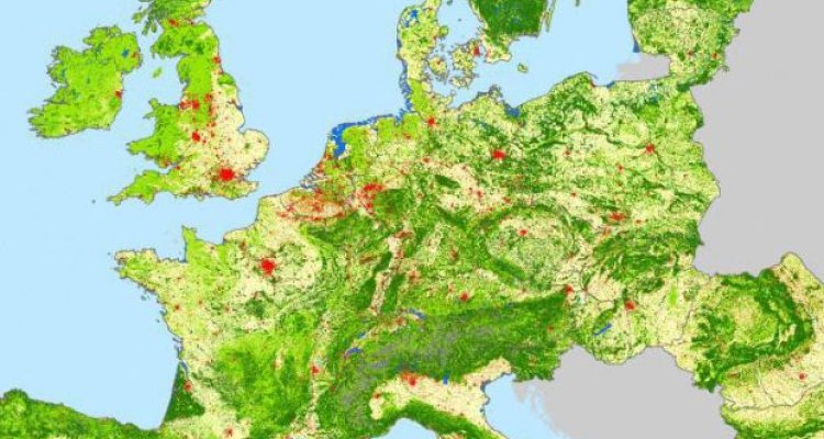
This research aims to reconstruct historic European land cover/use and its changes for the period from 1900 to 2010 using more detail in terms of land cover/use classes and a higher spatial resolution as compared to previous studies. The main objective of this thesis is to explore new reconstruction methods that improve the spatial and temporal detail and reduce the uncertainty in the estimates at continental level by better using available data sources. The use of available historic data sets as input data for the reconstruction is evaluated.
It is hypothesized that this objective can be achieved by providing a full representation of gross land changes at continental scale in order to capture all major land change processes and their dynamics for Europe throughout the last century. The research also explores and discusses implications of those change dynamics on environmental and biogeochemical research, such as climate change research.Therefore, this research investigates the following research questions:
- Does the combination of different data sources, more detailed modelling techniques and the focus on land change dynamics allow the creation of an accurate, high resolution historic land change reconstruction for Europe covering the period 1900 to 2010?
- How can local/regional knowledge, like statistics from encyclopaedias and old topographic maps, be used in large scale reconstructions?
- To what extent do historic land cover/use reconstructions underestimate land cover/use changes in Europe for the 1900–2010 period by accounting for net changes only and how does that affect the European carbon fluxes?
Data sets of the historic reconstruction of land changes and further information can be obtained here.
This research is part of the GHG Europe project.