Project
Bridging the gaps: Towards consistentand high-frequency European forest monitoring
Temporally- and spatially-detailed satellite-based forest disturbance detection and classification methods need to be developed and integrated with ground-based data streams such as national forest inventories in order to provide timely and accurate information on European forest dynamics.
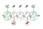
Research efforts into the use of remote sensing for European forest monitoring have expanded in recent years due to increasing policy demands from European forests. However, attempts to consolidate the fields of remote sensing and forest management have faced significant challenges. Current monitoring efforts are coarse, infrequent, unharmonized, and cannot adequately take increasingly frequent small-scale disturbances into account. In addition, remote sensing methods are not yet advanced enough to accurately detect on the temporal and spatial scale necessary for sub-yearly European forest monitoring. Integrating novel, high-frequency and high-resolution radar-based satellite data has the potential to overcome limitations of optical-based disturbance detection systems. Detection systems using radar-based data have been developed for the tropics but may be adapted for European forests. Therefore, this PhD project aims to realize consistent and frequently updated European forest information by bridging rapid satellite-based forest monitoring and cyclic ground-based forest inventories. Three related research objectives are:
1. Small-scale disturbance mapping using high-resolution radar satellite data.
2. Characterisation of disturbance sources and severities.
3. Integration with National Forest Inventory (NFI) plot networks.
The focus of this project will be on the use of high-resolution C- and L-band radar data (Sentinel 1 and SAOCOM), supplemented with optical data (Sentinel 2) for the development of novel disturbance detection algorithms. These will be integrated with existing NFI data. The expected outcome will be an integrated remote-sensing- and ground-based forest monitoring system for detecting, distinguishing, and classifying natural and human-made disturbances at a greater temporal and spatial resolution than ground-based inventories alone can facilitate.
