News
Inauguration: ‘Planning for Environmental Change’ - rural area reclassified
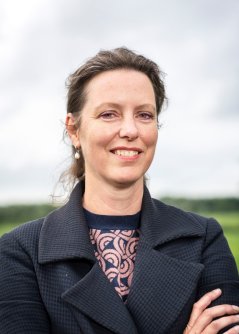
Spatial planning is very important in areas where space is scarce, for example in the Netherlands. Agriculture has always had a major influence on what our landscape looks like and how it functions, but this is no longer self-evident in times of climate change and loss of biodiversity. Martha Bakker, professor of Land Use Planning, believes that a reclassification of the Dutch countryside can reduce the pressure caused by lack of space while safeguarding everything that is beautiful and good about agriculture. On 21 April she will deliver her inaugural lecture: ‘Planning for Environmental Change’.
For a long time, the prevailing view was that the Netherlands was ‘finished’. Central spatial planning was no longer thought to be necessary, and that also affected the focus of the Land Use Planning Group, which Bakker has led since July 2019. Under her predecessors, it began to concentrate on urban areas, which, in a sense, made it just a planning group. But of course the Netherlands wasn’t completely finished. The undermining of ecological resilience was a dormant process that had been allowed to take place for decades and that led to a situation in dire need of a drastic reorganisation of rural areas.
Finally a specific spatial policy

It appears that politicians now too recognise the seriousness of the situation. After decades of generic policy, the emphasis is now on specific spatial policy: the so-called ‘area-specific approach’ with a central focus on the soil-water system. And it seems that the map that Bakker and her colleagues published last year in the journal Milieu, among others, played a driving and inspiring role.
On this map the rural area is reclassified. Bakker has opted for three zones: one for intensive agriculture, one for extensive agriculture and one for agroparks. In this way, the various sectors no longer hinder one another, and activities such as nature restoration can take place in the extensive areas. The Ministry of Agriculture, Nature and Food Quality is currently using a variant of this map as an informal basis for diverse policy explorations.
Need for a long-term vision
Bakker doesn’t consider the map to be perfect or as something that should be immediately implemented top-down; rather, she thinks that it can contribute to a long-term vision for the rural area. “This vision has been missing for years, which has been truly frustrating from the perspective of farmers.” She agrees that spatial planning should be delegated to the provinces because they have the most knowledge of their areas. “But,” Bakker added, “the national government should have the lead role. They should say, ‘Provinces, we’re going to steer towards different types of agriculture, and you have to indicate which areas are suitable for what. And here’s a bag of money to support the farmers in this transition.’”
Short lines and continual coordination
She advocates continual communication between the administrative layers. Bakker: “They have to keep their lines short and continue to try to align with one another. The province has to say: ‘If we fill it in like this and other provinces do that too, will that still be in line with the total nitrogen emissions and will we still meet the national standards?’ The area director must be able to say to the national government: ‘We’re encountering certain legislation that prevents us from making good agreements with the farmers.’ The national government can then take corrective measures.”
Bakker has advice for all those politicians and policymakers who are considering adopting her vision: “Don’t create compromises in advance because sometimes clarity is better than nuance. So make strict demands because they’ll eventually be mitigated. However, Bakker hopes that this will remain limited. “If we now really want to achieve something, then we have to support the willing by also prodding the rest with laws and regulations.”
Martha Bakker
- Studied physical geography at University of Amsterdam
- Received her PhD from Université Catholique de Louvain-la-Neuve (Belgium) on the topic of land use changes and soil degradation
- Began a postdoc at the Land Dynamics chair group at Wageningen University & Research after her PhD
- Has been chair of the Land Use Planning Group since 1 July 2019