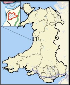
Cor Fochno (Borth Bog)
Habitat types: Lowland raised bog, estuarine mudflats and saltmarshes, dune complexes and shingle, wet woodland, swamp and coastal wet grassland.
Cors Fochno (Figure 2) is the largest uncut area of lowland estuarine raised bog in the UK and still retains an active peat forming dome of ~ 200 ha.

Plants characteristic of the active dome include bog moss species (Sphagna sp.), Erica tetralix (cross-leaved heath), Andromida polyfolia (bog rosemary), Eriophorum angustifolium (common cotton grass), Calluna vulgaris (heather), and Rhynchospora alba (white beak-sedge). Myrica gale (bog myrtle) and Eriophorum vaginatum (Hare’s tail cotton grass), Narthecium ossifragum (Bog asphodel) and Drosera (sundew) sp. are also locally abundant. Scarcer species include Vaccinium oxycoccus (cranberry), Menyanthes trifolia (bogbean) and Rhynchospora fusca (brown beak sedge).
Key indicators of active bog include Spaghum pulchrum, S. cuspidatum, S. papillosum and Drosera anglica (greater sundew). Molinea caerulea (purple moor grass) is abundant on the more disturbed sections of the bog and Phragmites australis (common reed), Juncus maritimus (sea rush) and Schoenus nigricans (black bog rush) occur on areas affected by former saline incursion. Habitats surrounding the bog include mud and sand flats, sand dunes, saltmarshes, reed swamp, wet woodland, marshy grassland and improved/semi-improved grasslands grazed mainly by cattle and ponies.
Important features of the area in and around the bog include submerged fossil forests and the layers of peat and estuarine sediment provide an important palaeo-environmental and archaeological (last 7000 years) record of the area. Hand peat cutting was extensively carried out during the 18th, 19th and early 20th century and mainly around the margins of the dome. However, this activity and channelization and diversion of the River Leri have led to fragmentation of the bog and drainage subsidence. Many areas drained were improved for agriculture and the transitions between the estuarine environment in the north and the shingle and dune ridge to the west were severed by the road and rail networks and the channelization of the Leri.
These constructions took place in the first half of the 19th Century. The drainage has led to shrinkage and subsidence of the peat, which has impacted on the vegetation species composition and dynamics, particularly in the margins and partly because of increased burning under drier conditions. Encroachment of wet woodland and scrub and natural seeding are also leading to changes in plant community composition (Fig. 3). The bog is further affected by the threats posed by human intervention (construction of flood defences, agricultural practices; Fig. 4), the combined impacts of shrinking around the margins and sea level rise, and climate change.Cors Fochno is currently managed by the Countryside Council for Wales (CCW) although is also designated as a Special Area of Conservation (SAC), a Ramsar site and a Core Conservation Zone of the Dyfi Biosphere. The main objectives for management are to:
- Restore active peat forming conditions, maximising peat growth and elevation
- Prevent deterioration of the peat archive (through drying and oxidation) and loss of carbon to the atmosphere.
- Restore areas of degraded mire by hydrological controls and appropriate grazing.
- Maintain or increase all rare and notable species populations.
- Enhance the landscape quality of the bog and surrounding ecosystems.
- Control encroachment of woody vegetation, prevent or reduce fire damage and monitor important conservation features and environmental influences (e.g., aerial deposition).
- Maximise scientific research, education and access as far as compatible with the scientific features.
A wide range of research data are available for the site, with this collected as part of a series of diverse and often interdisciplinary projects (Table 1).
| Source/sensor | Data range |
| Aerial Photography | 1972 and 1999 |
| Daedalus Airborne Multispectral Scanner | Not applicable |
| Ordnance Survey maps | SN68 and SN69 |
| Historical scanned maps | 1790, 1794, 1804, 1837, 1875, 1928 |
| Field plots/transects (11 permanent) | Ongoing |
| Digital Phase 1 habitat map | 1970-1990 |
| Digital habitat map (satellite-based) | 2003-2006 |
| Digital National Vegetation | Not applicable |
| Classification (NVC) map | Not applicable |
| Landsat -4/5 TM and ETM+ | 1984-Present |
| ASTER/IRS | ~2000-Present |
| CASI L1b | 2002 |
| Airborne Thematic Mapper | 2002 |
| Hyperspectral and LiDAR | 2009 |
| NEXTMap Britain - topographic data | SN69 |
Current studies are focusing on understanding how nitrogen pollution and changing climate will affect the biodiversity and ecosystem properties of peatlands (EU PEATBOG), the hydrology of raised bogs and implications for ecosystem restoration, various aspects of carbon cycling including methane emissions and dissolved organic carbon release. Research has also led to the development of a state-of-the-art hydrological model for raised bogs and advances in the remote sensing of plant communities (e.g., sphagnum-dominated) and palaeo-ecology. Collectively, this work is leading to the development of bio-indicators of risk for conservation managers and policy applications. A monograph for the site is currently being compiled which will include ecological and physical science.