News
Satellite images show unprecedented Arctic fires
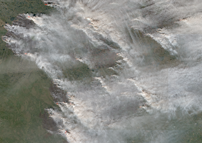
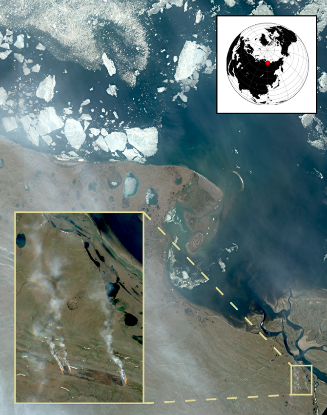
In 2019 and 2020, fires of unprecedented scale have been observed in the Siberian Arctic, burning large areas of carbon-rich soils. Satellite observations reveal that in two years, more of the Arctic burned than in the previous four decades. A new study in Science links the unprecedented fire activity to regional warming: rising summer air temperatures are driving Artic fires to increase near exponentially.
Wildfires are common in the Arctic and Subarctic. “But 2019 and 2020 were exceptional years,” details lead author Adrià Descals from CSIC and CREAF. “In 2020 alone, we detected 423 fires that burned 3 million hectares (an area the size of Belgium) and emitted 256 million tons of CO2 equivalent. This is comparable to all the CO2 emitted by Spain in a year.” The authors expect the size, frequency, and intensity of Arctic fires to increase further as the climate warms. The temperature trend is reaching a threshold in which small increases in temperature are associated with large increases in the area burned.
Analysis of four decades of satellite observations
Using satellite observations from 1982 to 2020, the authors quantified the area burned in a region of 286 million hectares above the Arctic Circle in Siberia, Russia. The observations were captured in breathtaking satellite images. “While observations indicated that the 2020 fire season was exceptional, there was little quantitative evaluation in this vast remote region. We set out to fix that”, said co-author David Gaveau from TheTreeMap, a company studying fires.

The scientists showed that various factors that promote fires have increased with temperature in recent decades. Between 1982 and 2020, the summer air temperature increased by 0.66°C per decade. In 2020, the average summer temperature was 11.53 degrees – 2.82 degrees higher than the average of the previous four decades. Professor Douglas Sheil from Wageningen University & Research and coauthor on the study, notes that summer temperatures have reached a dangerous threshold. “Any small additional increases above 10°C lead to a sharp increase in area burned and associated emissions. Remarkably many of the fires erupted over this vast and near uninhabited region within just a few days, which appears hard to explain unless lightning associated with electrical storms is the cause – something that remains to be verified.”
Large carbon storage
The permafrost peatlands of the Siberian Arctic store considerable carbon. Burning produces the greenhouse gasses carbon dioxide and methane. This sets in motion additional processes of deeper thawing and soil respiration, that also release carbon and make the remaining peat more vulnerable to future fires. The release of carbon also creates a positive feedback with additional emissions contributing to further climate warming, leading in turn to further thawing of the permafrost, greater frequency of conditions that favor extensive fires and associated emissions.
