
Colloquium
Use of Remote Sensing Techniques to Optimize Vegetation Parameters of Wave Damping Modelling
By Elbert de Hon
Abstract
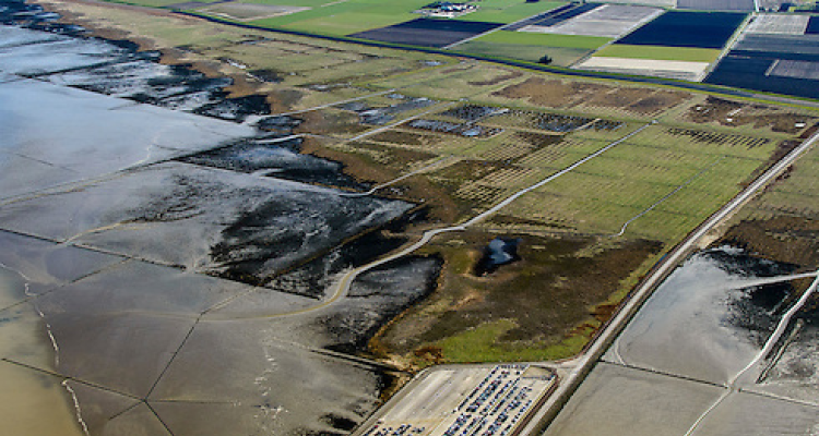
The main topic of this research is the coastal safety in the Netherlands. Parts of the Netherlands are situated below sea level and are vulnerable for flooding’s. Hence, the dunes present in coastal areas are quite important to protect this country and need to be maintained. Beside dunes, dikes and dams were and are developed and constructed to protect the Netherlands. The last decades a shift took place from more technical measures to an incorporation of nature into the world of flood protection. This new approach is called ‘Building with Nature’. Nature is used instead of or complementary to present flood protection measures. Examples are vegetated foreshores like salt marshes as present in the province of Zeeland, Friesland and Groningen. Vegetated foreshores break the incoming waves and reduce the impact of water on the present constructions. A possible advantage of this wave breaking effect of vegetation in front of flood protection measures could be a less robust design of dams or dikes. In order to include vegetation in the design of flood protection measures numerical water models are used like XBeach. This model allows to include vegetation in the analysis of water flow influencing coastal zones using different vegetation parameters. To determine these parameters often used methods are literature research and field research. In this master research a method was developed using remote sensing techniques to determine the vegetation parameters XBeach asks for. As a test case a salt marsh close to Holwerd, in the province of Friesland, was chosen. Field data was combined with remote sensing data using Object-based image analysis in order to get a better insight in the spatial distribution of the physical characteristics of the vegetation. Finally, a surface covering vegetation structure map, with an accuracy of 82%, was created based on the relevant vegetation structure parameters XBeach asks for: vegetation height, stem diameter, stem density and a drag coefficient.