Use case
Drones for agriculture and nature monitoring
Drones are unmanned airborne vehicles (UAVs) that are able to collect spatial information by flying over specific areas. These high-resolution data can be used for various application purposes.
They are increasingly used to collect different types of information and answer questions such as:
- What plant traits can be seen in the crops/vegetation in a specific region?
- How do plants/crops develop?
- Which vegetation changes are taking place in the short term due to natural events or the influence of management/lack of management?
- How should farmers adapt their field management practices (task maps for precision farming)?
- How many animals does a region have?
Our approach: generating and processing data
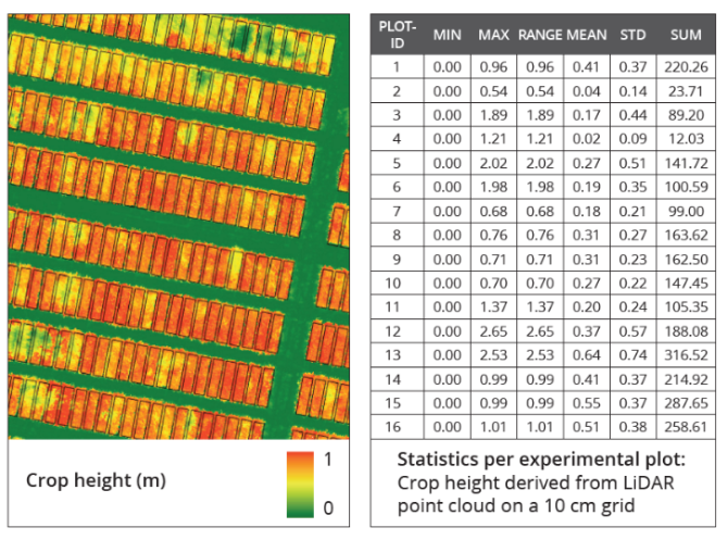
The spatial information obtained by drones is determined by the type of camera, which can be multi-spectral, hyperspectral, thermal or 3D laser scanning. Extremely detailed spatial information can be collected in a short period of time, which can be used to answer questions posed by end users, such as the ones listed above.
Drones can collect information in low-centimetre resolution, which enables us to characterise specific objects, such as individual plants and trees. This huge volume of data can then be processed by computers into indicators at the field or landscape level, which is useful for end users.
(Expected) impact of the approach
Drones are only used when information is needed at a centimetre to decimetre resolution that cannot be obtained from satellites. This mainly concerns detailed and up-to-date information on a relatively small area, like an agriculture field, a nature area or a forest. Drones can generate data on plant biomass, height, chlorophyll content, etc. The number of drone applications in the terrestrial and marine domain is increasing steadily.
Next steps
Drones equipped with multispectral, hyperspectral, thermal or laser scanning cameras can produce a huge volume of high-resolution data at almost any location and time for a wide range of applications. Nevertheless, the flight area is still very much restricted by such regulations as flying within the visual line of sight (VLOS). Flying beyond the visual line of sight (BVLOS) should be the next step, along with autonomous flying. This will increase both operational applications and business services.
Given the time it takes to process the data, a more concerted effort should be made to automatically process drone data, including the use of on-board RTK GPS for high positional accuracy. The continued development of machine learning for object identification and characterisation will also improve the operational processing chain.
Facts and figures

Tools used
- Drone tool for processing drone data in the cloud for standardised products.
- Riegl and remote sensing/GIS software for processing raw data and further analysis.