
Nieuws
Global mapping of soil salinity change
An article of Konstantin Ivushkin, Harm Bartholomeus, Arnold Bregt, Alim Pulatov, Bas Kempen and Luisde Sousa: Global mapping of soil salinity change, has been published in Remote Sensing of Environment, Volume 231.
Abstract
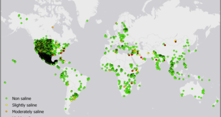
Soil salinity increase is a serious and global threat to agricultural production. The only database that currently provides soil salinity data with global coverage is the Harmonized World Soil Database, but it has several limitations when it comes to soil salinity assessment. Therefore, a new assessment is required. We hypothesized that combining soil properties maps with thermal infrared imagery and a large set of field observations within a machine learning framework will yield a global soil salinity map. The thermal infrared imagery acts as a dynamic variable and allows us to characterize the soil salinity change. For this purpose we used Google Earth Engine computational environment. The random forest classifier was trained using 7 soil properties maps, thermal infrared imagery and the ECe point data from the WoSIS database. In total, six maps were produced for 1986, 2000, 2002, 2005, 2009, 2016. The validation accuracy of the resulting maps was in the range of 67–70%. The total area of salt affected lands by our assessment is around 1 billion hectares, with a clear increasing trend. Comparison with 3 studies investigating local trends of soil salinity change showed that our assessment was in correspondence with 2 of these studies. The global map of soil salinity change between 1986 and 2016 was produced to characterize the spatial distribution of the change. We conclude that combining soil properties maps and thermal infrared imagery allows mapping of soil salinity development in space and time on a global scale.
Keywords: Soil salinisation; Google Earth Engine; Landsat; SoilGrids