Thesis subject
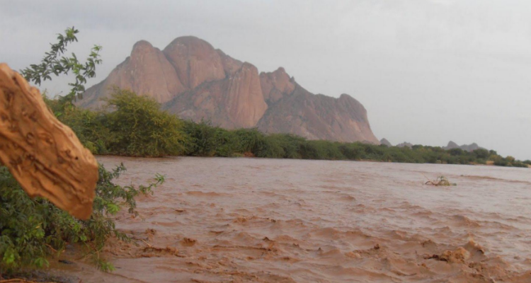
Rainfall runoff modelling using public domain datasets: Gash River
Background and requirements
Computation of runoff from river catchments is required for different purposes. Information on river flow is needed to optimally operate downstream irrigation and hydropower reservoirs. Often river flood forecast is the main component of flood early warning systems, whereby flood damages can substantially be reduced if a high flood is forecasted well in advance. However, in many situations, the river catchments are located across country borders. Often data sharing protocols are not in place (e.g., Nile basin countries), and rainfall runoff computation become impossible with ground station data. In many catchments the density of rainfall stations is very sparse to obtain reliable areal rainfall estimates. In such cases, public domain datasets, monitored through remote sensing techniques can be an effective replacement. Fortunately, rainfall measurement by remote sensing techniques has attained major advancements during last decades. The quality of data -both accuracy and resolution (spatial and temporal) has improved considerably. Most of the data is available free of charge in the internet, e.g.:
Research objectives
The objective of this research is to test different options of public domain climate datasets (rainfall,temperature, etc.) for accurate rainfall-runoff computation.
Method
- The researcher will inventories and download potential datasets required for rainfall runoff modelling, mainly rainfall data, but other climate parameters as well.
- Evaluate accuracy of remotely sensed rainfall data against ground station measurements.
- Develop rainfall runoff model using data from ground stations as well as from satellite.
- Evaluate accuracy of the computed runoff to recommend most suitable dataset.
Note 1: Ground climate data (rainfall, temperature, river flow) for the period of the investigation will be provided from an ongoing research project on the Gash River (Smart-ICT, Sudan).
Note 2: Researcher may select a suitable hydrological model; however it is preferred to use one of the public domain rainfall runoff models
Output
The researcher should come up with MSc. Thesis, and possibly a journal article out of the thesis.
Funding
It is possible to provide support for field data collection from the ongoing Smart-ICT project, Sudan, for a period of 2-3 weeks (air ticket, accommodation, field cost, etc.)
Background material
Alemseged, T. H. and T. H. M. Rientjes, (2007). Spatio-Temporal rainfall mapping from space: Setbacks and strengths.
Furuzawa, F. A. and K. Nakamura, (2005). Differences of rainfall estimates over land by Tropical Rainfall Measuring Mission (TRMM) Precipitation Radar (PR) and TRMM Microwave Imager (TMI) - Dependence on Storm Height. Journal of Applied Meteorology 44: 367-382.