
Geography and Data Science
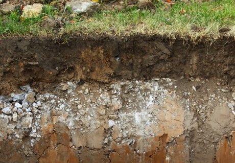
We explore soil patterns and soil properties at different scales in space and time. We develop methods for quantifying soil properties combining expert knowledge, data science, geostatistics, remote and proximal sensing, and process-based modelling. We explicitly quantify uncertainties.
Our Geography and Data Science projects


Our Geography and Data Science senior scientists
-
dr. JA (Julian) Helfenstein
Changes in soil quality across space and time -

prof.dr.ir. GBM (Gerard) Heuvelink
Mathematical and statistical techniques -
dr. A (Annegret) Larsen
Biota, humans and fire on earth-surface-processes -
dr. PSJ (Philip) Minderhoud
Spatial-temporal modelling of deltaic subsidence -
dr.ir. VL (Titia) Mulder
Remote sensing; spatial, temporal and soil-landscape modelling -
dr.ir. JJ (Jetse) Stoorvogel
Soil-land use interactions -
dr. V (Slava) Vasenev
Internet of things technologies and remote sensing to monitor urban soils and green infrastructure