News
AI system predicts illegal deforestation: Already prevented the clearing of 30 hectares near a gold mine'
Deforestation is one of the major threats to the climate and vital habitats for humans and animals. Forest Foresight, the new intelligent system developed by the World Wildlife Fund (WWF), can predict illegal logging. Wageningen University & Research is working on making the system even smarter, and the initial results in Gabon (Africa) are promising.
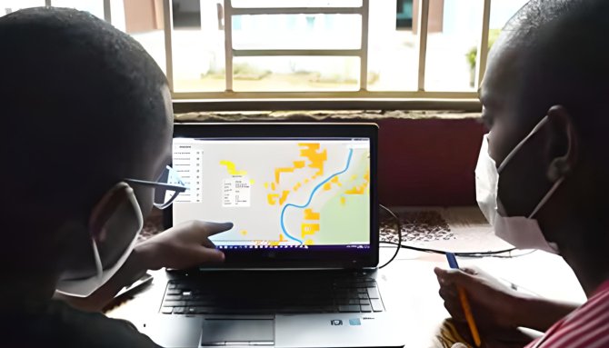
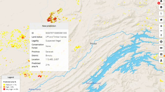
A system that predicts deforestation and issues a local warning is groundbreaking. While there were existing systems to detect deforestation, they often acted too late to prevent actual clearing. Forest Foresight indicates areas at risk for deforestation months in advance. Utilizing satellite imagery and other data, it creates a detailed map showing where logging might occur. Currently, the WWF is testing the systems in tropical forests in Suriname, Gabon, and Kalimantan. Local rangers venture into identified high-risk areas to verify the potential threats.

The initial results are encouraging: in Gabon and Kalimantan, illegal deforestation activities have been thwarted. "Based on Forest Foresight, we've taken 34 actions in six months to stop deforestation," say involved parties in Gabon. Additionally, an illegal gold mine was discovered in time, saving 30 hectares of forest. Multiple illegal gold traders were arrested by park management.
Taking causes of deforestation into account in predictions
Johannes Reiche, Associate Professor in Radar Remote Sensing at Wageningen University & Research, leads the research on the new AI system. He is supported by AI expert Postdoc Laura Cué la Rosa. "We're teaching the system the dynamics of deforestation," he explains.
It starts with the primary input for Forest Foresight, coming from the RADD (Radar for Detecting Deforestation) system. RADD utilizes radar images from the Sentinel-1 satellite, which can see through clouds. This allows detection of new roads, indicating the arrival of heavy transport, or where clearing has occurred every few days. "This system generates a massive amount of data needed for Forest Foresight," Reiche says.
"But the beauty is that we're not just using these satellite images; we're also teaching the system the causes of deforestation," he continues. "We investigate the underlying reasons, examine associated datasets, and feed them into the system, allowing it to discover and map patterns."

How does it work? "In a recent study, we used satellite data to identify causes of deforestation in our study areas. The main causes are mining, small-scale agriculture, large-scale agriculture – such as for palm oil or soy – and selective logging for the timber industry. The system learns to recognize these activities. Different types of forests are also considered. For example, there's less likelihood of logging in certain wet forest areas. This way, the system can accurately assess where the chances of illegal deforestation are highest."
A next step Reiche aims for is using smartphone locations combined with remote sensing and AI in areas where nobody should go, like reserves. "This is already happening in preventing illegal fishing. It's a great example of using various techniques. The crucial aspect is always that it should be easy to use locally, so the system runs well on-site. It should be used there, not in Wageningen."
Local action perspective for patrols
With Forest Foresight, the foundation has been laid for the future preservation of primary tropical rainforests in close collaboration with governments and local communities, according to the WWF. More countries at high risk of deforestation are in the pipeline. The goal, together with international partners, investors, and local collaborators, is to roll out Forest Foresight systematically from 2024. The ambition is to be active in fifteen landscapes across twelve countries by 2027, significantly reducing illegal deforestation.
"I see that this system gives people on the ground much more perspective for action," says Reiche. "With minimal requirements, organizations can see where patrols need to go, enabling useful expeditions through the forest. That's quite different from always playing catch-up. Through collaboration with the WWF and local populations, we genuinely have something in our hands."