News
Analysing changes in landscapes to answer big questions
Kirsten de Beurs, the new Professor of Geo-information Science and Remote Sensing, wants to help her chair group answer big questions, develop interdisciplinary collaborations, and help build a better academic world.
Remote Sensing is the science of acquiring, processing and interpreting information about the earth from a distance. Based on satellite or drone photos, for example, researchers study social and geographical changes, such as deforestation, the growth of cities, or the impact of conflicts. As the new chair holder in Geo-information Science and Remote Sensing, Professor Kirsten de Beurs uses developments in technology to search for answers to big questions in the landscape: “Our visual material is becoming more and more detailed. All that data is very important, but it also needs to be analysed. What story do these images tell? That remains our main question.”
On 14 December, De Beurs will deliver her inaugural lecture to the academic community, entitled ‘Reflected Light to Narratives’.
Human scale
“When I graduated in 2002, 1-metre resolution images had just become available in the Netherlands. It took 15 minutes for such a photograph to load. We also worked with time series of images, with cells of 8 kilometres,” De Beurs says. “Nowadays, we can also work with time series of high-resolution images. So we can look at smaller changes in the landscape, on a much more human scale.”
De Beurs gives two examples of projects in which remote sensing experts provide important data. After the first war between Azerbaijan and Armenia, a malaria epidemic ravaged the war zone, even though the disease had been under control in the region for years. How could that be? “Our research showed that old irrigation canals, which were needed for agriculture, had been poorly maintained during the war. This produced stagnant water, in which mosquitoes could easily multiply.”
In Central Asia, researchers from the chair group are looking at the growth of cities. Among other things, they create heat maps and study the outskirts of the city. “These are areas where construction is expanding into the agricultural area. We want to know what consequences this has, how it affects the surrounding area.”
Interdisciplinary collaboration
To tell the whole story, researchers from the group collaborate with other experts, such as ecologists, meteorologists, and forestry experts. “A mosquito plague is not yet a malaria epidemic,” De Beurs stresses. Anthropologists discovered that various groups of soldiers had travelled from other areas to fight in the war. They had brought the disease with them. For the research study in Asia, the researchers are not only looking at images, but also distributing questionnaires to better understand human well-being within the city.
“Wageningen has lots of great experts. In my field, we like to work with experts who know exactly how a forest works or how water behaves. An important part of our work is talking to them to find out what information from a landscape is important for their field.” These indicators are then used by remote sensing researchers to look for valuable data in images of the landscape.
Ensuring that the images are correct
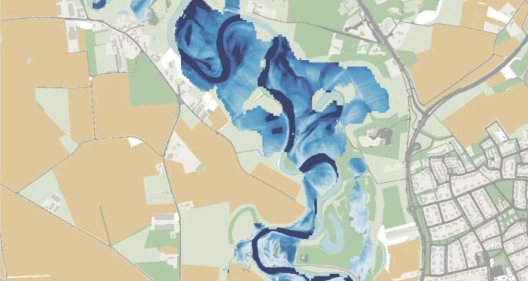
The introduction of new technology such as drones or radar imagery brings many benefits. Radars, for example, do not work with reflected sunlight, but produce their own radiation on a longer wavelength. “This radiation goes through the clouds, making it possible to take photographs of flood plains during storms, for example.” A combination of radar imagery and other data can help researchers learn even more about an area.
Now students are coming to me because they would like to work with a woman. I want to take my position of role model seriously.
De Beurs does not want to lose sight of the more fundamental side of her field. She explains that it is still important for remote sensing researchers to have a good understanding of how the images they use are created. “To guarantee that our conclusions are correct, we need to be able to guarantee that our images are correct. Not much has changed in that respect. We are still mainly looking at light waves reflected from the earth.”
Building a diverse university
With this chair, De Beurs is coming back to her alma mater after more than 20 years. For most of her career, she studied and worked in the United States, where she became the second youngest and first female head of the Department of Geography and Environmental Sustainability at the University of Oklahoma. “I got a lot of satisfaction from that leadership position. Your own research shifts into the background. It becomes your responsibility to help others do their best research.”
“As a professor, you help build academia,” says De Beurs. “You are partly responsible for making it as good as it can be.” In that context, De Beurs also mentions her role as a role model for female students. “I've personally had very good mentors during my career. They were all men, though. Now students are coming to me because they would like to work with a woman. I want to take that position of role model seriously, and contribute to building a more diverse university.”