Project
Land suitability mapping
Since FAO’s ground-breaking ‘Framework for land evaluation’ in 1976, many studies have been carried out to support land use decisions enabling the efficient use of natural resources, while at the same time conserving those resources for the future. Such studies have been performed for both developing and developed countries considering the differences in the natural resource base and using a wide range of methods from conventional common-sense approaches to computer simulations.
Insight in the agro-ecological suitability of land for a well-defined use is helpful to identify areas that are most promising to increase current production levels and/or to develop new areas for a given agricultural activity. Suitability mapping contributes to the discussion where a given crop can be best produced given prevailing biophysical conditions of soils and climate and the need to use natural resources as efficient as possible.
In recent decades, many digital high-resolution databases on land use, soil properties, weather data and other resources have become available. At the same time, new digital tools have been developed to combine, analyse and visualise such data in maps. The mapping of land suitability is a powerful means of communicating results with stakeholders in a spatial context.
Over time, the Business unit Agrosystems Research has conducted various land suitability studies in the field of food security and specific crop opportunities for different clients. Here, you find a preview of these studies with a web-link that gives more details on each study.
Studies
Seed potatoes in Indonesia
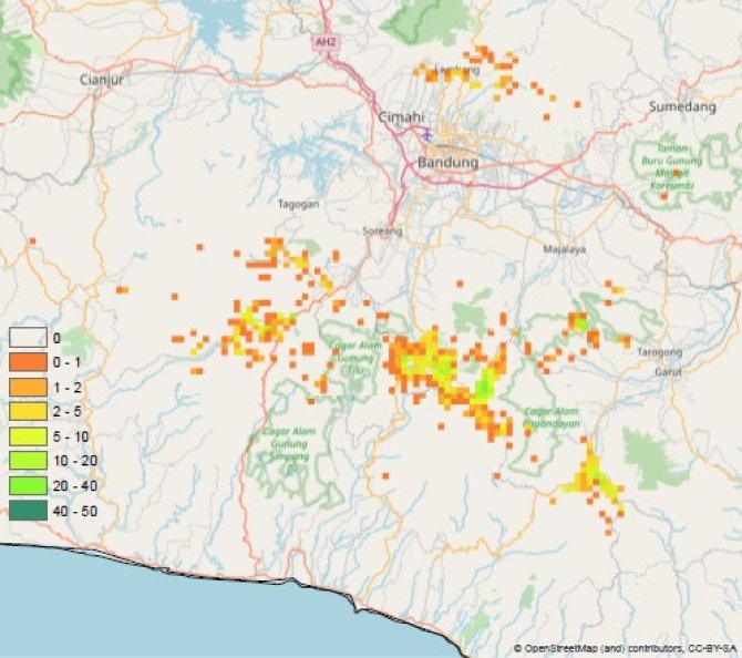
The production of seed potatoes in Indonesia is limited because it depends on scarce land resources in the highlands. What is the potential to produce seed potatoes and where in Indonesia?
Duration: 2020
Project: vegIMPACT NL (www.vegimpact.com)
Contact person: Sjaak Conijn
Shallots in Indonesia
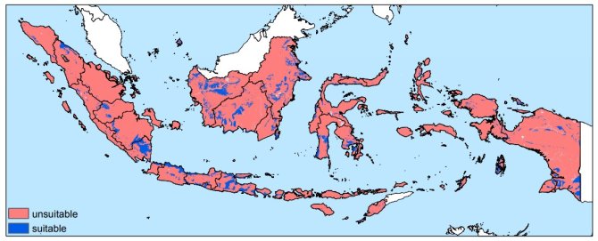
The production of shallots based on true seeds is new to Indonesia. The research question was to identify new suitable areas for the production of shallots based on true seed given local agro-ecological conditions.
Duration: 2016
Project: vegIMPACT (www.vegimpact.com)
Contact person: Huib Hengsdijk
Suitable areas in Africa
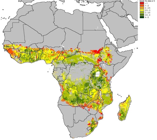
Increases in both crop yield and fertilizer use efficiency are needed in Sub-Saharan Africa. We simulated optimum nitrogen fertilizer use efficiencies of maize as a benchmark to improve maize cultivation in Sub-Saharan Africa.
Duration: 2012-2016
Project: Benchmarking of local crop N and water use efficiencies
Contact person: Sjaak Conijn


